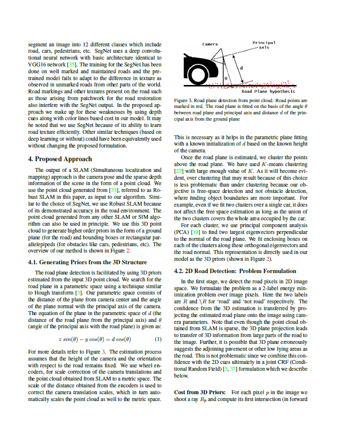
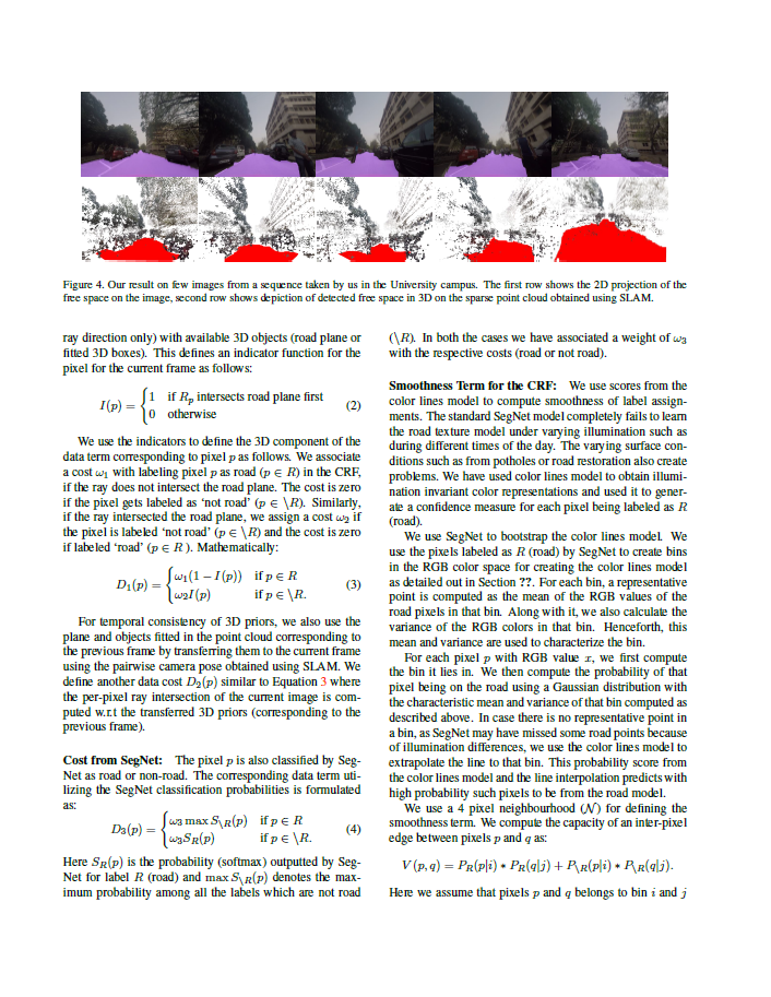
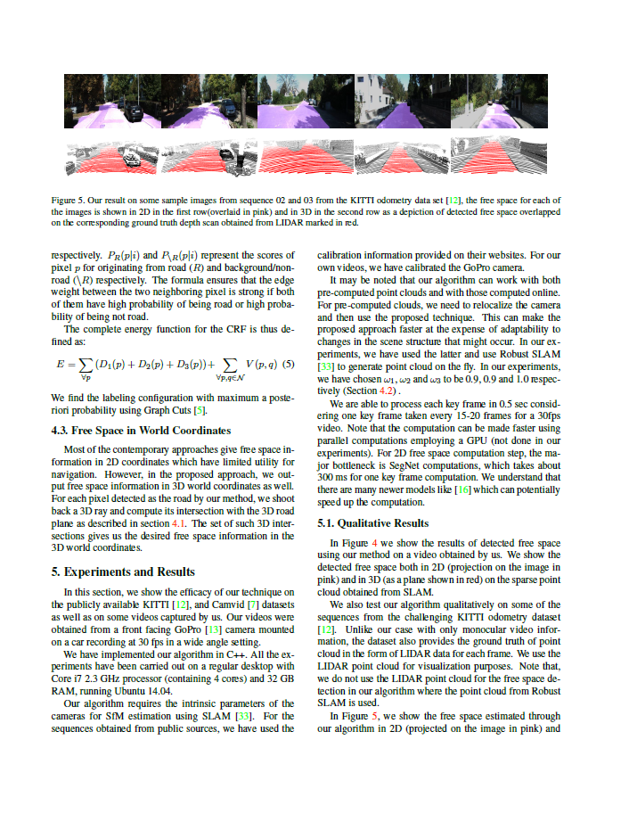
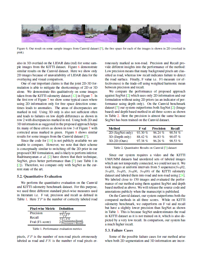
In this paper, we address the problem of road segmentation
and free space detection in the context of autonomous
driving. Traditional methods either use 3-dimensional (3D)
cues such as point clouds obtained from LIDAR, RADAR
or stereo cameras or 2-dimensional (2D) cues such as lane
markings, road boundaries and object detection. Typical
3D point clouds do not have enough resolution to detect fine
differences in heights such as between road and pavement.
Image based 2D cues fail when encountering uneven road
textures such as due to shadows, potholes, lane markings
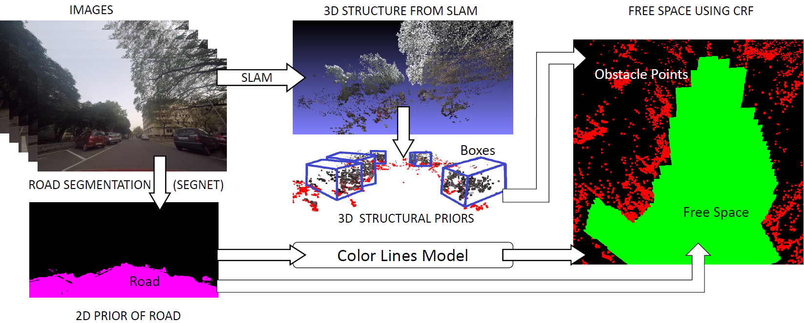
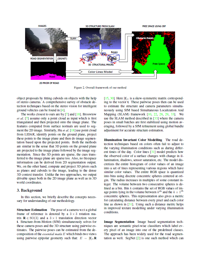
or road restoration. We propose a novel free road space
detection technique combining both 2D and 3D cues. In
particular, we use CNN based road segmentation from 2D
images and plane/box fitting on sparse depth data obtained
from SLAM as priors to formulate an energy minimization
using conditional random field (CRF), for road pixels classification.
While the CNN learns the road texture and is
unaffected by depth boundaries, the 3D information helps
in overcoming texture based classification failures. Finally,
we use the obtained road segmentation with the 3D depth
data from monocular SLAM to detect the free space for the
navigation purposes. Our experiments on KITTI odometry
dataset, Camvid dataset as well as videos captured
by us validate the superiority of the proposed approach over
the state of the art.
WACV 2018 Paper - A Joint 3D-2D based Method for Free Space Detection on Roads
Demo
Overview
PDF
@inproceedings{wacv18_roadseg,
  title     = {A Joint 3D-2D based Method for Free Space Detection on Roads},
  author    = {Suvam Patra and Pranjal Maheshwari and Shashank Yadav and Subhashis Banerjee and Chetan Arora},
  booktitle = {Proceedings of the IEEE Winter Conference on Applications of Computer Vision (WACV)},
  year      = {2018}
}